Maps?
-
jbook

- Silent Watcher over the Peaceful Lands
- Posts: 153
- Joined: Wed Feb 24, 2010 2:58 pm
- Location: The Shire/Rohan
- Contact:
Maps?
I'm sure there has been a topic on this before but has anyone attempted map making? I LOVE maps and always have. I was wondering if we could maybe share some map drawings. It can be an enlarged section of middle-earth. Or it could be a vast landscape of your own making. Just thought it would be a fun to try.
-
Eledhwen

- Thangailhir
- Posts: 1346
- Joined: Mon Jul 21, 2008 10:09 pm
- Location: Nandaromar, Rhovanion
- Contact:
Re: Maps?
I use Campaign Cartographer to make maps for RPG and related items. Not generally topo in nature.
I learned to make maps from measurements taken on the ground while in the Corps...quite accurate they are too, using nothing more than a compass, known pace count, and a protractor. Haven't done that in a while.
But I do love maps. I do spend a deal of time updating my topo maps while out and about around here.
Eledhwen
Nandalad!
Re: Maps?
This is a map I made for a D&D campaign I tried running. I ended up spending more time working on the map and the backstory of the land then actually figuring out how I was going to run the campaign. As a result we only played one game of that campaign, and I ran a slightly simpler one instead.
To make this I first drew out the first draft on paper then I "scanned" it into my pc (I took a picture of it) and used my tablet in photoshop to redesign and do the rest of the work.
I'm not the best at coming up with names, so you might recognise some...
http://i186.photobucket.com/albums/x235 ... ap005d.jpg
~PER ARDUA~
Rhiavas Thavronion
Rhiavas Thavronion
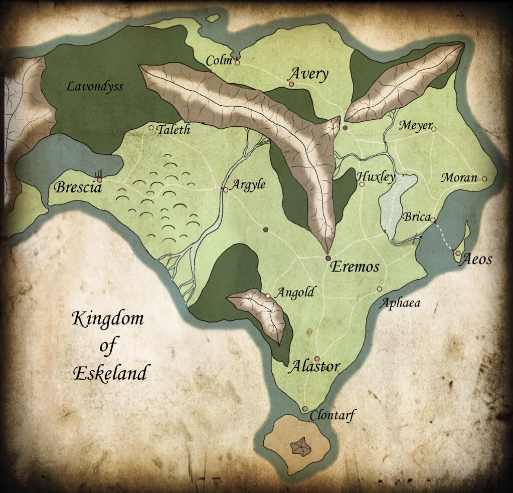
Re: Maps?
I like making maps very much. Usually I prefer drawing them on paper, but have tried different digital options too.
Here's the best one, I've made this far:

Uploaded with ImageShack.us
It's for a LARP world we use around here. Don't pay attention to the writings.
Here's the best one, I've made this far:

Uploaded with ImageShack.us
It's for a LARP world we use around here. Don't pay attention to the writings.
-
Greg

- Urush bithî 'nKi ya-nam bawâb
- Posts: 4502
- Joined: Tue Dec 02, 2008 8:50 pm
- Location: Eriador; Central Indiana
Re: Maps?
I've done a bit of mapping of the area I trek around with charcoal or inks on parchment in a small notebook I got from Borders. It's made with some leaves from some area near india, I think...but it looks really cool and middle-earthy, so it's sort-of become my trekking journal. I map my areas in it, I make notes on the maps of good places to find edible plants, quail coveys, game trails, lookout points, stream crossings, and other useful tidbits. I don't usually carry it with me, but it's nice to make note of things I've found while I've been out. At some point, I'll try to get around to scanning a few of my maps and post them here.
Now the sword shall come from under the cloak.
Re: Maps?
And remember Bilbo had this big map on his wall too 
-
Beornmann

- Silent Watcher over the Peaceful Lands
- Posts: 329
- Joined: Fri Jun 27, 2008 1:57 pm
- Location: NE Ohio
Re: Maps?
Previous Discussion under subJ: Cartography
Near is the hour when the Lost should come forth, And the Grey Company ride from the North.
-
David

- Silent Watcher over the Peaceful Lands
- Posts: 156
- Joined: Thu Jun 25, 2009 12:33 am
- Location: San Diego, CA
- Contact:
Re: Maps?
Surprisingly, as much as I suck at drawing, and most other forms of art (excluding writing and music of course), I can draw maps fairly well. Well, I can make my own maps fairly well. When I actually try and make my own maps of a region, on the other hand, they're not so good/accurate. It's definitely fun though!

You will live by the sword and you will serve your brother. -Genesis 27:40
-
Greg
- Urush bithî 'nKi ya-nam bawâb
- Posts: 4502
- Joined: Tue Dec 02, 2008 8:50 pm
- Location: Eriador; Central Indiana
Re: Maps?
I can vouch. Dave can draw a mean map, and the fantasy weaponry concept art he's drawn to accompany his novel is awesome as well.
Now the sword shall come from under the cloak.
Re: Maps?
Oh I had a great time making a map for my film the other day, I put alot of work into it and I feel it has come out well, you can see it here:
http://www.youtube.com/watch?v=0LcNbvYAx4Q
-Chris
http://www.youtube.com/watch?v=0LcNbvYAx4Q
-Chris

Re: Maps?
I use a program called Dunjini for map making.. but it's mainly for using for RPG games.
“From the ashes a fire shall be woken, A light from the shadows shall spring; Renewed shall be blade that was broken, The crownless again shall be king.â€
http://www.mackermakkeep.com
http://www.mackermakkeep.com
Re: Maps?
I once did an atlas for a middle-earthy world- I drew the world map and divided it into sections then drew each of those sections then drew maps of all the towns. It wasn't accurate scale and stuff but it did look pretty nice... as a matter of fact i've still got a few sections to do..
Life before Death.
Strength before Weakness.
Journey before Destination.
-
Ranger of Arthedain

- Silent Watcher over the Peaceful Lands
- Posts: 180
- Joined: Wed Dec 29, 2010 8:37 am
- Location: Numenor
- Contact:
Re: Maps?
I've been getting my materials together so I can attempt at hand drawing a map of Middle Earth. Heh, mother didn't find it too amusing when I cleared the pictures off the wall in behind her desk since it's the right size of wall space I need. 
I've been thinking of doing what Greg has stated he's doing with a trekking journal, it sounds as if it may be interesting to keep up with.
I've been thinking of doing what Greg has stated he's doing with a trekking journal, it sounds as if it may be interesting to keep up with.
When the snows fall and the white winds blow, the lone wolf dies, but the pack survives. Winter is almost upon us, it will be long and hard, but the North remembers and the wolves will come again.
-
RikJohnson

- Silent Watcher over the Peaceful Lands
- Posts: 345
- Joined: Wed May 05, 2010 3:48 am
- Location: Tucson, Az.
- Contact:
I LOVE MAPS!
My Hyborian persona is a Nemedian Cartographer and I've done numerous articles on cartography for the Edgar Rice Burroughs sites.
The two big rules for maps are:
ONE: maps lie!
There is no truely accurate map. anywhere! A map will have whatever yopu feel is important.
Guidemaps indicate the locations of the latrines and interesting sights but rarely terraine or milage.
USGS and National Ordinance maps are good but mostly outdated. Plus neither show contours below water which Fish-n-go maps do provide.
Even the Tolkein maps listed only items that were relevant to the story and so one gets the impression that there were only acouple town in Middle Earth because Tolkein never mentioned the others.
In reality, a Middle-Earth type land would have a city surrounded by dozens of supporing villages and farms.
TWO: maps are rarely accurate.
Most maps are made by the guy who wandered through the area and drew what she saw, but he probabl;y was not a cartographer nor surveyor so he may have said "It is 10 days march form A to B and as I walk 20 miles a day, it must be 200 miles!"
In reality, he was doing between 10 and 20 miles, or less, waling a winding path and so the crow-files distance was probably coloser to 100 miles.
Still, I love maps and collect them as I can and created a couple websites for fictional maps.
Those who give up a little freedom in place of a little security will soon discover that they possess neither.
-
Straelbora
- Haeropada
- Posts: 937
- Joined: Mon Feb 11, 2013 7:00 pm
- Location: Indianapolis, IN USA
Re: Maps?
I've done a couple of maps of Middle Earth on leather using a wood burning tool. I like the way they came out.
And on a sad side note, my sister lived down the street from Karen Wynn Fonstad, the woman who did the official Atlas of Middle Earth, and only bothered to mention it to me after Ms. Fonstad had passed away.
And on a sad side note, my sister lived down the street from Karen Wynn Fonstad, the woman who did the official Atlas of Middle Earth, and only bothered to mention it to me after Ms. Fonstad had passed away.
Vápnum sÃnum skala maðr velli á
feti ganga framar þvà at óvist er at vita
nær verðr á vegum úti geirs um þörf guma
Hávamál
feti ganga framar þvà at óvist er at vita
nær verðr á vegum úti geirs um þörf guma
Hávamál